

 Send Inquiry
Garmin Etrex 20
Garmin Etrex 20 Specification
- Features
- Preloaded worldwide basemap, supports custom maps, IPX7 waterproof, paperless geocaching, trip computer, area calculation
- Interface Type
- USB
- Weight
- 141.7 grams (including batteries)
- Usage & Applications
- Ideal for hiking, adventure trip, travel, geocaching
- Type
- Handheld, Portable GPS
- Dimensions
- 5.4 x 10.3 x 3.3 cm
- Battery Backup
- Up to 25 hours with 2 AA batteries
- Frequency
- L1 (GPS standard)
About Garmin Etrex 20
Garmin Etrex 20
| Physical & Performance | |
| Unit dimensions, WxHxD: | 2.1" x 4.0" x 1.3" (5.4 x 10.3 x 3.3 cm) |
| Display size, WxH: | 1.4" x 1.7" (3.5 x 4.4 cm); 2.2" diag (5.6 cm) |
| Display resolution, WxH: | 176 x 220 pixels |
| Display type: | transflective, 65-K color TFT |
| Weight: | 5 oz (141.7 g) with batteries |
| Battery: | 2 AA batteries (not included); NiMH or Lithium recommended |
| Battery life: | 25 hours |
| Waterproof: | yes (IPX7) |
| Floats: | no |
| High-sensitivity receiver: | yes |
| Interface: | USB |
| Maps & Memory | |
| Base map: | yes |
| Preloaded maps: | no |
| Ability to add maps: | yes |
| Built-in memory: | 1.7 GB |
| Accepts data cards: | microSD card (not included) |
| Way points/favorites/locations: | 2000 |
| Routes: | 200 |
| Track log: | 10,000 points, 200 saved tracks |
| Features & Benefits | |
| Automatic routing (turn by turn routing on roads): | yes (with optional mapping for detailed roads) |
| Electronic compass: | no |
| Touchscreen: | no |
| Barometric altimeter: | no |
| Camera: | no |
| Geocaching- friendly: | yes (paperless) |
| Custom maps compatible: | yes |
| Photo navigation (navigate to geotagged photos): | yes |
| Outdoor GPS games: | no |
| Hunt/fish calendar: | yes |
| Sun and moon information: | yes |
| Tide tables: | no |
| Area calculation: | yes |
| Custom POIs (ability to add additional points of interest): | yes |
| Unit-to-unit transfer (shares data wirelessly with similar units): | no |
| Picture viewer: | no |
| Garmin Connect compatible (online community where you analyze, categorize and share data): | yes |
Reliability in Challenging Conditions
With an IPX7 waterproof standard, the Garmin eTrex 20 can endure rain, splashes, and even accidental submersion, making it well-suited for unpredictable outdoor environments. Its robust construction ensures your data remains safe no matter where your adventures take you.
Custom Mapping Capabilities
The eTrex 20 supports Garmin custom maps and BirdsEye Satellite Imagery, allowing explorers to personalize navigation. Load topographic, street, or satellite maps through USB 2.0 connectivity, enhancing route planning and situational awareness in both urban and wilderness settings.
Optimized for Extended Exploration
Powered by just two AA batteries, the unit offers up to 25 hours of operation, perfect for extended trips. It stores 10,000 track log points and up to 200 saved tracks, letting you document and revisit previous routes efficiently.
FAQs of Garmin Etrex 20:
Q: How do I load custom maps onto the Garmin eTrex 20?
A: To load custom maps, connect your eTrex 20 to a computer via USB 2.0. Use Garmins BaseCamp or MapInstall software to transfer compatible custom maps or BirdsEye Satellite Imagery to the devices internal memory or microSD card.Q: What types of batteries does the eTrex 20 use, and how long do they last?
A: The eTrex 20 operates on two AA batteries, either alkaline or NiMH rechargeable. With quality batteries, you can expect up to 25 hours of usage, making it suitable for long outdoor excursions without frequent battery changes.Q: When is the IPX7 waterproof rating beneficial for users?
A: The IPX7 rating means the device can withstand incidental exposure to water, such as splashes, rain, or submersion in up to 1 meter of water for 30 minutes. This is beneficial for outdoor activities like hiking, boating, or exploring in wet conditions.Q: Where can I use the Garmin eTrex 20 for navigation and mapping?
A: You can use the eTrex 20 globally, as it features a preloaded worldwide basemap and supports custom maps. Its ideal for hiking trails, travel in remote regions, geocaching adventures, and both import/export fieldwork in locations across India and abroad.Q: How does the eTrex 20 record and manage waypoints, routes, and tracks?
A: The device can store up to 2,000 waypoints and 200 routes, along with a track log of 10,000 points and 200 saved tracks. This organization helps you mark points of interest, design new routes, and review or revisit previous tracks easily during your trips.Q: What are the benefits of the trip computer and paperless geocaching features?
A: The trip computer provides valuable statistics like distance, speed, and time, assisting with navigation and progress tracking. Paperless geocaching allows you to download detailed cache descriptions, logs, and hints directly to the device, eliminating the need for printed materials.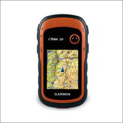
Tell us about your requirement

Price:
Quantity
Select Unit
- 50
- 100
- 200
- 250
- 500
- 1000+
Additional detail
Mobile number
Email

More Products in Garmin Gps Device Category
Garmin Oregon 550t GPS
Price 700 INR / Unit
Minimum Order Quantity : 100 Units
Weight : Approx. 6.8 oz (192.7 g) with batteries
Display : Other, 3axis, 65K color, 240 x 400 pixels, sunlightreadable touch screen
Type : Other, Handheld GPS Navigator
Dimensions : 2.4 x 4.5 x 1.4 (6.1 x 11.4 x 3.6 cm)

GPS Radio Collars
Weight : 380 g
Display : Digital
Type : Other, Wireless
Dimensions : 28 x 15 x 7 cm

Garmin eTrex 10 GPS
Price 7000 INR / Piece
Minimum Order Quantity : 1 , , Piece
Weight : 10 Kilograms (kg)
Display : Analog
Type : GPS Navigator
Dimensions : 1 Meter (m)
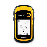
Garmin Etrex 10
Price 14000 INR / Piece
Minimum Order Quantity : 1 Piece
Weight : 10 Kilograms (kg)
Display : Analog
Type : GPS Navigator
Contact Details
- FLAT NO 306, DOOR NO 3-83/1/PC/306, Panchsheel Complex, NIZAMPET.Hyderabad - 500090, Telangana, India
- Phone : 08045476222
GLOBAL TELE COMMUNICATIONS
GST : 36AHTPR9067J1ZA
- Mr Ganesh Chandu R. (Managing Director)
- Mobile : 08045476222
- Send Inquiry
- Mobile :+919866661290


GLOBAL TELE COMMUNICATIONS
All Rights Reserved.(Terms of Use)
Developed and Managed by Infocom Network Private Limited.
Developed and Managed by Infocom Network Private Limited.
